Aerial view of African urban periphery
Genesis

METROLAND.
Commodifying land: Capital, inequalities and conflicts in sub-Saharan African metropolitan peripheries.

An ANR-funded multi-dimensional study documenting the socio-spatial and land-tenure dynamics of metropolitan peripheries in Bamako, Dakar, and Nairobi (2022–2026).

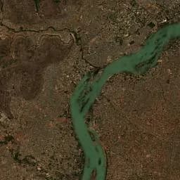
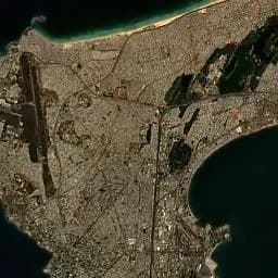
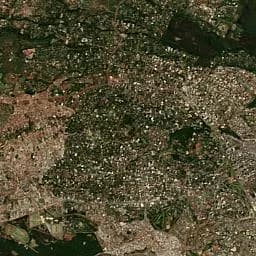
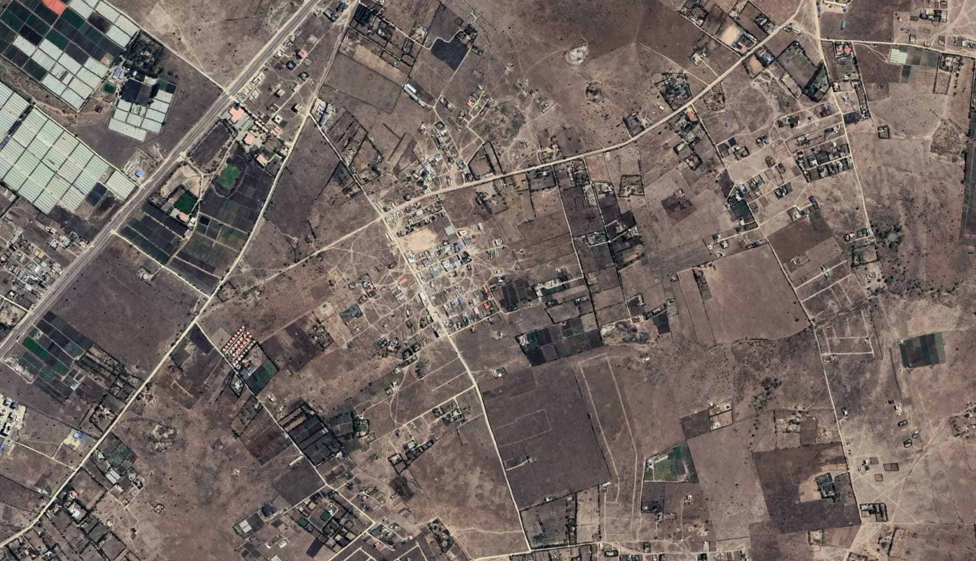
In 2020, 728 million people, more than 56% of the population, live in cities in Africa. Africa is experiencing one of the fastest urban growth rates, which has defied several SDGs over the last decade: the built-up area has almost doubled since 1990 (OECD 2020); 950 million additional inhabitants are expected by 2050. The resulting unprecedented spatial expansion of cities gives rise to hybrid landscapes on land previously used for rural livelihoods deep into the hinterlands, blurring the boundaries between rural and urban.

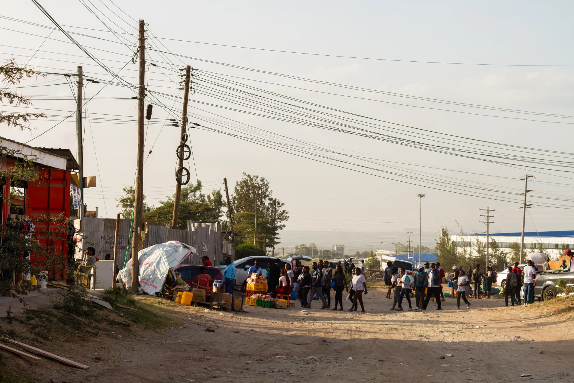
Urbanisation processes in Africa take specific forms due to population growth and the lack of industrialisation. The impoverishment of the countryside and the attraction of urban life lead to strong urban population growth. Due to space-consuming urbanisation patterns, this growth results in even stronger spatial expansion, at the expense of agriculture, pastureland, or even forests or natural wetlands. Formal and informal peri-urban land markets are exposed to diverse influences: national policies favouring macro-economic growth and integration into international financing circuits, urban demographic pressure, and social changes linked to the schooling of young rural and urban generations and local economic mutations. Poorly regulated, the commodification of land and speculative practices on the margins are taking on a new dimension, now affecting all strata of society. These dynamics enhance competition between unequally endowed actors trying to access available land. They have tremendous impacts on previous inhabitants' livelihoods and the environment.

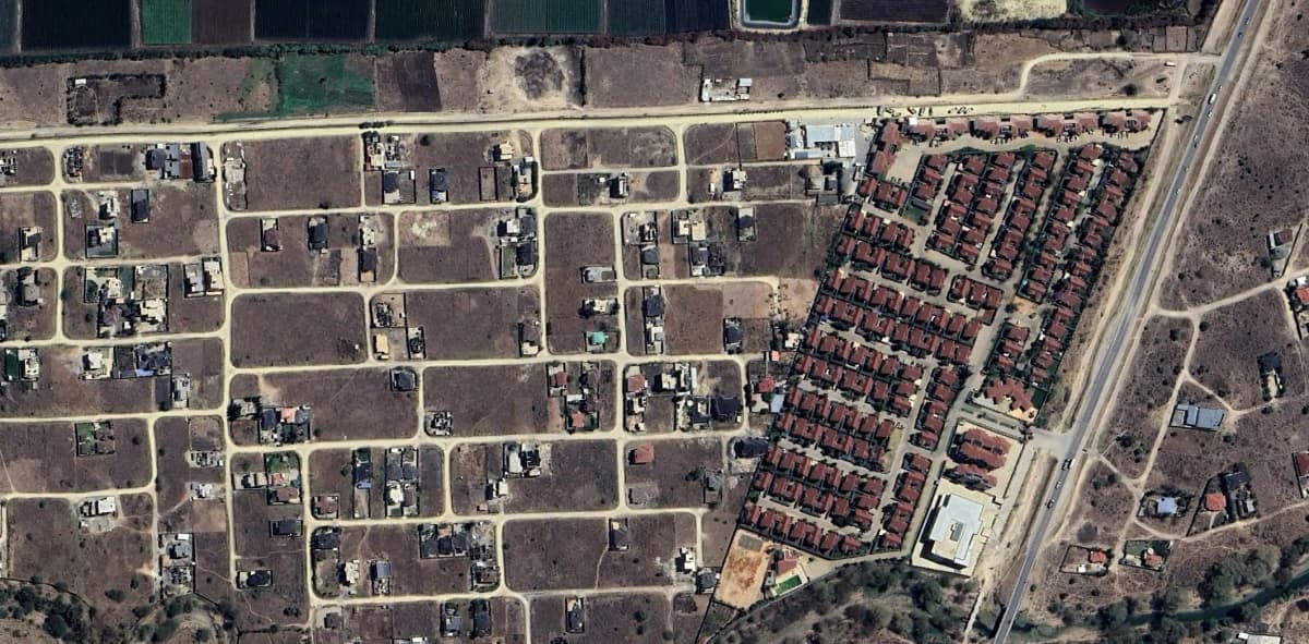
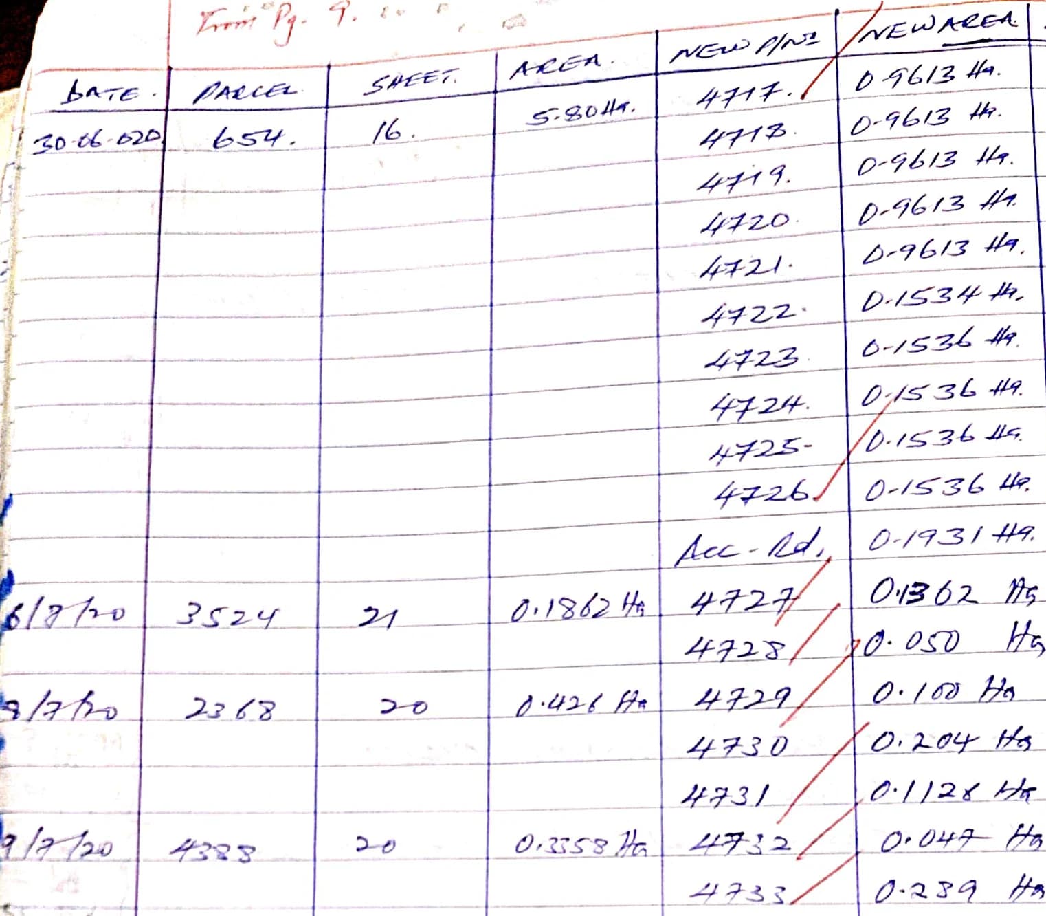
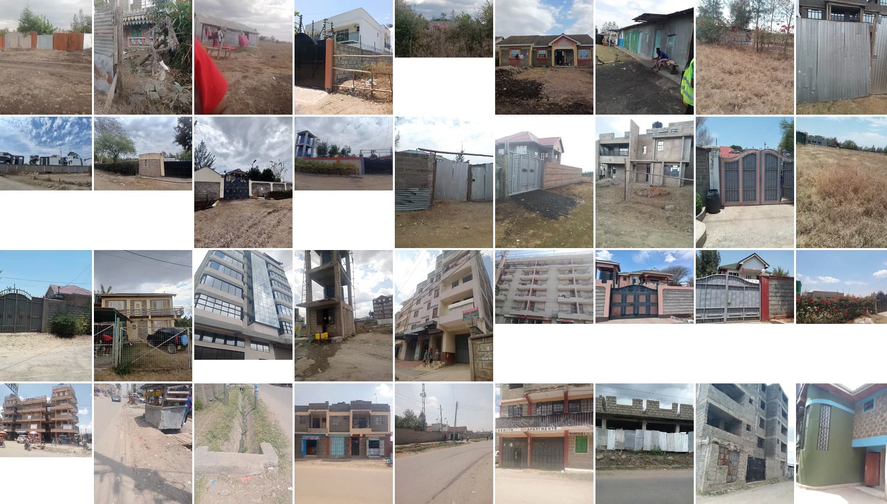
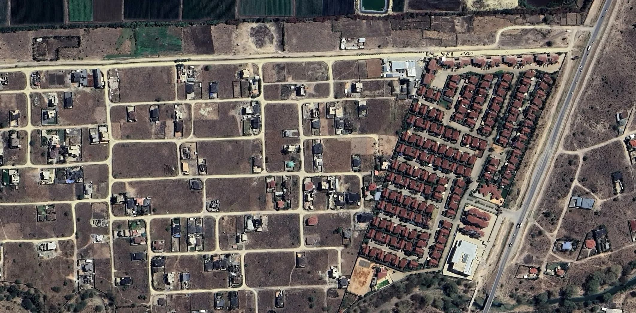
Urban sprawl also takes various spatial configurations. Many houses are built each year by individual owners or private companies, leading to diverse urban forms. Many plots are also taken without immediately translating them into value creation in the form of buildings. Land hoarding is considerable, with plots remaining undeveloped years after their acquisition. Due to its profitability, peri-urban land is a safe investment in contexts of uncertainty and in societies where many individuals are unbanked. Thus, land becomes a reserve and trading currency beyond the expected investment functions.

“Urban sprawl feeds multiple speculations, anticipation strategies and varied real estate profit-sharing.” — METROLAND Project Hypothesis

Current or future urbanisation based on these land processes raises major issues: access to housing, basic services and infrastructure for a growing population; transformation of rural societies and agricultural practices; financial risks; impacts of soil artificialisation on the environment and natural resources. The socio-spatial reconfigurations of rural/urban territories produce specific land access and resource inequalities that create and deepen socio-economic inequalities. These rapid changes and their issues in terms of socio-spatial justice lead to conflicts and social mobilisation that try to challenge them.

Research Objectives

Our ambition is to produce innovative, rigorous and appropriable research, which will contribute to current academic and policy debates on African urbanisation processes through five research objectives:

  • 1To reassess the patterns and speed of urban sprawl in the three metropolises, taking into account diffuse housing, ordinary land-use conversions and the diversity of urban forms produced.
  • 2To better understand these patterns of urban sprawl through examining the diverse kind of investors (public and private, business and households, rural and urban) and their outcomes in terms of urban forms and territorial inequalities.
  • 3To point out the issue of socio-spatial justice involved in these processes, for former as well as new inhabitants, through the assessment of social and demographic change, rural dweller strategies, new inhabitant profiles.
  • 4To analyse people's capacities and empowerment to address these socio-spatial issues and influence the urbanisation process through conflicts, social and legal mobilisation.
  • 5To examine the will and capacities of central and local governments involved in the territories to regulate the commodification of land and the urbanisation patterns.

Case Studies

We focus on the peripheries of Bamako (Mali), Dakar (Senegal) and Nairobi (Kenya). These metropolises are capital cities from French and English-speaking African countries facing legal pluralism, diverse post-colonial land law regimes and different current political configurations. We have selected these three metropolises because they represent a gradient in size, population, and importance of public and private investments, which steer our comparative analysis.

Aerial view: Bamako, ML
Bamako, ML

Kati district — selection of sites of varying distances from major roads, representative of various land status.

Aerial view: Dakar, SN
Dakar, SN

Sangalkam, Bambilor & Diamniadio — housing projects competing with intensive agriculture and public megaprojects.

Aerial view: Nairobi, KE
Nairobi, KE

Kitengela, Konza & Isinya — land acquisition fronts, real estate transitions, and new urban nodes.

Kenya

Konza in Machakos county and Kitengela and its periphery in Kajiado County, on the eastern front of Nairobi's expansion (new semi-arid land acquisition fronts, speculation hotspots).

Senegal

Sangalkam and Bambilor communes (to the north-east of Dakar's expansion; progressive urbanisation as a result of individual purchases and housing projects competing with intensive agriculture) and Diamniadio (location of major public projects).

Mali

Where the expansion of Bamako demonstrates both linear and scattered forms, a selection of sites in Kati district, of varying distances from the major roads, and representative of various land status, agricultural and residential uses.

Visual overview of METROLAND project objectives

Research Objectives — METROLAND Project Framework

Methodology

Work Packages

Our project is structured around four interconnected work packages combining remote sensing, ethnographic fieldwork, and spatial analysis.

WP1
WP1 methodology illustration

Urban sprawl patterns and territorial reconfigurations on the metropolis fringe

This WP measures the changes occurring in the outskirts of the three metropolises under consideration and specifically contextualises the land-use changes, which will then be addressed through case studies. Measures of land-use changes from agricultural or natural land to fallow or built-up land in sub-Saharan Africa are rare in the academic literature, since the published or official sources are insufficient. We mobilise quantitative data to specify land use and land cover changes on territorial fringes, using several scales of analysis: the metropolitan area, local authorities and communities (communes, localities), and the land parcel. Our aim is to evaluate the process of urban expansion - in time and space - and characterise its forms in detail. We analyse land conversion fronts with the support of already proven methods and more original means, including: satellite imagery, census databases, Africapolis data, Open Street Map data, and available real estate and land web advertisements, to produce a new GIS using Aphélion, TerrSet, QGis, and R software. At the metropolitan scale, we follow population evolution and urbanisation trends over ten years. At the local level, we measure the forms that urbanisation takes in detail. We examine the implementation of housing estates through high-resolution satellite images available for the three metropolises since 2001 (Google Earth). We will then check whether the urban transition of the land corresponds to the socio-economic changes revealed by the Household and Individual data from the last censuses of the three countries. Finally, at the local and parcel level, we identify parcels of land indicating any change in ownership, access to services and land development. We complete this cartography with a land and real estate database compiled from online advertisement sites since 2020.

WP2
WP2 methodology illustration

Public policies, land markets and investors' trajectories

This WP examines the modes of access to land and land-use conversions linked to urbanisation dynamics. We pay attention to the diversity of actors who acquire, sell and subdivide land, thus driving land markets. We identify three transversal approaches, and aim at increasing the scope for generalisation. The sociology of investors and modalities of transfer of land rights: We question investors' profiles, motivations, and sources of financing. This economic and political positioning is analysed in its institutional and legal dimensions and through land acquisition processes that may combine formal and informal practices, clientelist manoevres within the State, and local negotiation games. We highlight the gradual takeover of the territory by public or private development and subdivision projects, including plots built on or left as fallow land. We examine how investors acquire land rights, and their resale or accumulation strategies. We clarify the typology of urban sprawl forms initiated by WP1 by characterising the legal land status and the investor. The value chains activated by land transactions: We analyse the production of land rent linked to the commodified circulation of property titles. We examine the strategies of economic anticipation that this generates, the relations between land markets and financial markets, and the value chains it allows. The social inequalities resulting from these processes: We examine the changes in land ownership and land uses in specific territories and whether it reinforces economic and even environmental vulnerabilities and contributes to the formation of new coalitions of interest. We analyse land transactions by combining qualitative (interviews, ethnographies) and quantitative methods (constitution of databases with recorded titles and property transfers extracted from land registries and cadastral databases and their statistical and cartographic analysis; statistical and cartographic analysis held from the regis... (line truncated to 2000 chars)

WP3
WP3 methodology illustration

Former and current users of the peri-urban resources, new socio-spatial inequalities

This WP addresses reconfigurations at work in a moving rural-urban interface. It examines the increasing competition for peri-urban land resources, economic inequalities to which merchant transactions give rise and, as an introduction to the tensions studied in WP4, new territorial legitimacies resulting from these changing uses and users. We highlight in the three metropolitan areas: The shrinking of agricultural surfaces experienced by rural producers due to land pressure; The 'road factor' which guides the urban sprawl but induces new territorial discrimination; Emerging real estate markets, variously driven and regulated by the public authorities; The interplay between different sources of action and legitimacy: landowners and land users; local land operators and private estate developers; indigenous people and residents from elsewhere.

WP4
WP4 methodology illustration

Social groups in action: land tenure insecurity, conflicts and mobilisation

This WP examines land conflicts that take place on urbanisation fronts. Land conflicts, sometimes violent, regularly make the headlines in the media and social networks. We analyse how they are rooted in land tenure insecurity and/or dispossession experienced by rural actors and/or new inhabitants. Land dispossession in urban fringes results from processes led by state, local governments and/or private investors that mix legal procedures and power relations. Governments' reactions to protests oscillate between wait-and-see and repression. The WP analyses the mobilisation and resistance strategies of farmers and inhabitants in the face of urbanisation projects, both public and private, they see as sources of dispossession. It questions the forms of political mobilisation - non-violent or violent – and the relationship of local actors to the state (and sometimes national or international activist groups), the place of law and justice in these claims, and discuss their capacity to block or subvert the projects they reject. It also looks at the mobilisation of new inhabitants faced with difficult access to land for housing and basic services and land insecurity. We analyse the origins of mobilisation and how the actors express their refusal to bring to light their perceptions of (in)justice, the conflicts of norms that they reveal and the nature of expectations and contestations concerning political authorities both national and municipal. We study the repertoires of norms used and the strategies to publicize the conflicts and find political support. We look at the diversity of positions on the conflicts, the cleavages that cross the opponents, and their evolution.